Loading Data
Find USDA Eligible Properties in Apache County

 browse list of realtors working in Apache County
Apache county has 1 usdaproperties.com realtor ready to help with your search!
| April Featured Agent | |
|---|---|
| Tamra Lee Ulmer | from Arizona Resource Realty |
 Contact an Agent for Help
 Looking to buy in Apache County, Arizona?
There are 132 USDA backed residential loans in Apache county with an average loan balance of $121,138. Over 83% of the loans helped first time home buyers. Borrowers were an average age of 39 years old. The typical appraised home value was around $124,348. On average the rural home size purchased with this loan was approximately 1,582 SqFt. Apache county applies the standard USDA income limits to determine loan eligibility. For a household of upto 4 people the income limit is $90,300. For a household of between 5 and 8 people the income limit is increased to $119,200.
The size of Apache County is roughly 29,058 square kilometers. There are no geographical USDA loan restrictions in this county. The influence score for Apache County is 8. Look below for the interactive county level map illustration below for more details.
Select from the list of cities below or use the search feature to find active property listings in a city where you would like to live.
Start your search for USDA loan eligible properties in the cities of Apache County, AZ 
* cities most likely to have USDA loan eligible properties for sale.
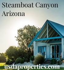
Adamana • Allentown • *Alpine • Blue Gap • Boneyard • Bonita Trading Post • *Burnside • Chambers • Chetco • *Chinle • *Concho • *Cornfields • Cove • Coyote Springs • *Del Muerto • *Dennehotso • Diamond Fields • *Eagar • El Tule • Emmanuel Mission • Feaster • Flat Rock • *Fort Defiance • *Ganado • Green Spot • *Greer • Hawley Lake • Horse Mesa • *Houck • Hunt • Hunters Point • Kinlichee • *Klagetoh • Los Burros • Lower Wheatfields • *Lukachukai • *Lupton • *Many Farms • Maverick • *McNary • Mexican Water • Mexican Water Trading Post • Milkwater • Navajo • *Nazlini • Northwoods • *Nutrioso • *Oak Springs • Pine Springs • Pinta • *Red Mesa • Richville • *Rock Point • Rosebud • *Rough Rock • *Round Rock • *Saint Johns • *Saint Michaels • Salado • Salina • *Sanders • *Sawmill • *Sehili • *Springerville • *Steamboat • Steamboat Canyon • Sunrise Springs • Tahchee • Tanner Springs • *Teec Nos Pos • Tes Nez Iah • Three Forks • Totacon • Toyei • Troweek • *Tsaile • Tsintaa Yiti Ii • Twin Falls • Upper Wheatfields • *Vernon • White Clay • *Wide Ruins • *Window Rock • Woodspring Trading Post • Yazzi
A USDA loan is a mortgage option available to eligible homebuyers that is sponsored by the United States Department of Agriculture to promote homeownership in rural communities. USDA Loans, sometimes called "RD Loans," offer 100% financing options on eligible rural properties. USDAProperties can help you find USDA properties in Apache County.
View the detailed USDA boundaries and read about general conditions of
Apache County, Arizona
 .
.Apache County is located in the northeastern corner of the U.S. state of Arizona. It was established on February 24, 1879, making it one of the four original counties in the Arizona Territory. The county is named after the Apache Native American tribes who originally inhabited the region.
Encompassing an area of 11,218 square miles, Apache County is the sixth-largest county in the United States by land area. The county is characterized by various landscapes such as mountains, fertile valleys, and plateaus. The county's seat is St. Johns, which has played an essential role in Apache County's growth and development.
Before European contact, the region was home to indigenous peoples, including the Apache and Navajo tribes. The arrival of Spanish explorers in the late 16th century began a period of colonization and conflict. Throughout the 19th century, relations between the Native American tribes and European settlers were tense, leading to battles and skirmishes.
The U.S. Army established Fort Apache in 1870 to control the native population and protect settlers during the Indian Wars. The fort ultimately played a significant role in establishing peace between the Apache tribes and the U.S. government.
Today, the county is home to a rich cultural heritage with the Navajo Nation, Fort Apache Indian Reservation, and Zuni Indian Reservation occupying a large part of its land. Tourism, natural resources, and agriculture sustain the economy.
Fun Fact: Apache County boasts the famous Petrified Forest National Park, which is home to one of the largest and most colorful concentrations of petrified wood in the world. This park also displays the fascinating geological feature known as the Painted Desert, a stunning expanse of vibrant hills characterized by brilliant hues of reds, blues, purples, and grays.
Featured Cities of Arizona