Loading Data
Find USDA Eligible Properties in Inyo County
 browse list of realtors working in Inyo County
Hey, are you a realtor interested in helping families find USDA eligible properties in Inyo County?
Join the USDAProperties Realtor Network
Looking to buy in Inyo County, California?
Select from the list of cities below or use the search feature to find active property listings in a city where you would like to live.
Start your search for USDA loan eligible properties in the cities of Inyo County, CA 
* cities most likely to have USDA loan eligible properties for sale.
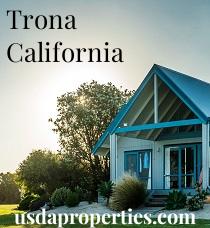
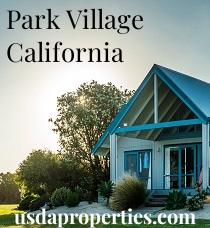
Aberdeen • Alico • Aspendell • Badwater • Ballarat • Bartlett • *Big Pine • *Bishop • *Cartago • Coso • Crater • *Darwin • Deep Springs • *Dixon LaneMeadow Creek • Dolomite • Dunmovin • Evelyn • Fish Springs • *Furnace Creek • Haiwee • Harrisburg • *Homewood Canyon • *Independence • Indian Village • Kearsarge • *Keeler • Keough Hot Springs • Laws • Leadfield • Linnie • Little Lake • *Lone Pine • Manzanar • *Mesa • Millspaugh • Mock • Monola • *Olancha • Oteys Sierra Village • Owenyo • Panamint • Panamint Springs • Park Village • *Pearsonville • Peterson Mill • Reward • *Round Valley • Rovana • Ryan • Scheelite • Scranton • Seven Pines • *Shoshone • Swansea • Sykes • Talus • *Tecopa • *Trona • Valley Wells • *West Bishop • Whitney Portal • *Wilkerson • Zurich
A USDA loan is a mortgage option available to eligible homebuyers that is sponsored by the United States Department of Agriculture to promote homeownership in rural communities. USDA Loans, sometimes called "RD Loans," offer 100% financing options on eligible rural properties. USDAProperties can help you find USDA properties in Inyo County.
View the detailed USDA boundaries and read about general conditions of
Inyo County, California
 .
.Inyo County is located in the eastern central part of the state of California, covering an area of about 10,227 square miles. Established in 1866, the county derived its name from the Native American word "inyo," which means 'dwelling place of the great spirit' in the language of the local Paiute tribe. With a population of approximately 18,000 residents, Inyo County is one of the least populated regions in California.
Situated in the shadow of the Sierra Nevada mountain range, Inyo County is characterized by its stunning landscapes, including Mount Whitney (the highest peak in the contiguous United States), Death Valley National Park (home to the lowest point in North America), the Ancient Bristlecone Pine Forest, and Owens Valley. Its varied terrain has contributed to the region's rich indigenous history, bustling mining activities in the 19th and early 20th centuries (including the famed California Gold Rush), and its prominence as a popular filming location for Hollywood movies, particularly Westerns.
A fun fact about Inyo County is that it contains the oldest known living organism on Earththe Methuselah Tree, a Great Basin Bristlecone Pine located in the White Mountains. This ancient tree is estimated to be over 4,800 years old, making it a remarkable symbol of resilience and natural history.
Featured Cities of California