Loading Data
Find USDA Eligible Properties in Clay County

 browse list of realtors working in Clay County
Clay county has 3 usdaproperties.com realtors ready to help with your search!
| August 2024 Featured Agents | |
|---|---|
| Mattie Bell | from Century 21 Advantage |
| Natalie Proctor | from EXIT Realty Cahaba |
| Andrea Jones | from Andrea Jones - ReMax Around the Lake |
 Contact an Agent for Help
 Looking to buy in Clay County, Alabama?
There are 29 USDA backed residential loans in Clay county with an average loan balance of $97,550. Over 86% of the loans helped first time home buyers. Borrowers were an average age of 41 years old. The typical appraised home value was around $100,882. On average the rural home size purchased with this loan was approximately 1,642 SqFt. Clay county applies the standard USDA income limits to determine loan eligibility. For a household of upto 4 people the income limit is $90,300. For a household of between 5 and 8 people the income limit is increased to $119,200.
The size of Clay County is roughly 1,568 square kilometers. There are no geographical USDA loan restrictions in this county. The influence score for Clay County is 9. Look below for the interactive county level map illustration below for more details.
Select from the list of cities below or use the search feature to find active property listings in a city where you would like to live.
Start your search for USDA loan eligible properties in the cities of Clay County, AL 
* cities most likely to have USDA loan eligible properties for sale.
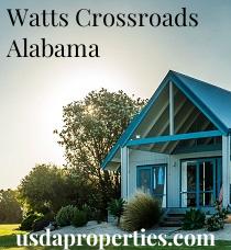
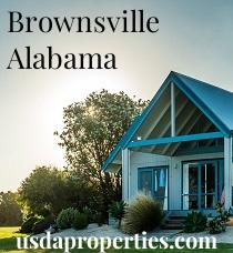
*Ashland • Barfield • Berwick • Bowden Grove • Brownsville • Campbell Springs • Campbells Crossroads • Carr Mill • Chambers Springs • Clairmont Springs • Cleveland Crossroads • Cooley Crossroads • Cragford • *Delta • East Mill • Erin • Gibsonville • Glades • Gunthertown • Harkins Crossroads • Haynes Crossroad • High Pine • *Hollins • *Lineville • Mellow Valley • *Millerville • Motley • Pinkneyville • Pyriton • Rays Crossroads • Roselle • Sikesville • Skeggs Crossroads • Springhill • Watts Crossroads • Weathers
A USDA loan is a mortgage option available to eligible homebuyers that is sponsored by the United States Department of Agriculture to promote homeownership in rural communities. USDA Loans, sometimes called "RD Loans," offer 100% financing options on eligible rural properties. USDAProperties can help you find USDA properties in Clay County.
View the detailed USDA boundaries and read about general conditions of
Clay County, Alabama
 .
.Clay County, located in the great state of Alabama, was established on December 7, 1858. It was named in honor of the famous American statesman, Henry Clay. The county is situated in the east-central region of the state and covers an area of approximately 606 square miles. The county seat is Ashland, with Lineville being another significant city within the region.
Prior to European settlement, the area was inhabited by Creek Indians. As more white settlers moved into the region, a series of conflicts known as the Creek Wars (1813-1814) took place, ultimately leading to the forced removal of the indigenous population along the infamous Trail of Tears.
During the Civil War, Clay County did not have any major battles or skirmishes, but it did provide approximately 2,500 soldiers for the Confederate cause. In the post-war era, the county's economy was mostly focused on agriculture, particularly cotton farming. In the late 19th and early 20th centuries, Clay County experienced growth due to the arrival of railroads and later, improved highways.
A fun fact about Clay County is that it was once home to the "High Rock Tower," a tourist attraction in the Alligator Hills area near the town of Delta. The tower was built to provide visitors with breathtaking panoramic views of the surrounding mountains and valleys, and included a dance pavilion, restaurant, and other attractions nearby. Sadly, many of the structures no longer exist, but remnants of the past can still be found in the area.
Featured Cities of Alabama