Loading Data
USDA Eligibility Boundaries for Ware, Georgia 


There are no geographical USDA loan restrictions in this county. 100% of Ware County is eligible for rural development USDA home loans.
The United States Department of Agriculture has rated the natural amenities of this region. On a scale of one to seven, Ware county is rated a 3. The average temperature during the month of June is 81.1℉ and the average temperature in January is 51.9℉. The typical humidity of this area is approximately 74% and the area covered by water is 0.44%. The overall influence score for Ware is 7.
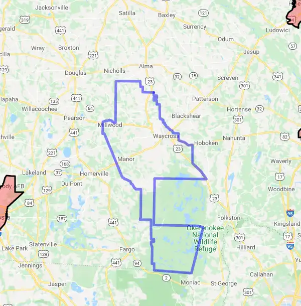
The map below displays geographic boundaries of Ware, Georgia with a blue border. There are no significant USDA regional restrictions in this county. For higher resolution imagery click the map to zoom in or search for specific postal (zip) codes, city names or even counties. You can also search for specific addresses using the power search feature here.
Select from the above list of cities in Ware County. Cities most likely to have USDA loan eligible properties are highlighted in the drop down list. Alternatively, use the search form to find your favorite counties, cities and zip codes in Georgia.

Ware County is located in south-central Georgia and is part of the Valdosta Metropolitan Statistical Area. The county seat is Waycross. As of 2019, the population was 36,312.
The racial makeup of Ware County is 73.2% White, 22.5% African American, 0.6% Native American, 1.1% Asian, 0.1% Pacific Islander, 1.2% from other races, and 1.4% from two or more races. Hispanic or Latino of any race were 3.8% of the population.
The median income for a household in Ware County was $37,722 and the median income for a family was $44,072. The per capita income for the county was $18,844. About 18.7% of families and 23.2% of the population were below the poverty line, including 33.9% of those under age 18 and 16.7% of those age 65 or over.
Living conditions in Ware County are generally good with a low cost of living and plenty of outdoor recreational activities available nearby such as hiking, camping and fishing at Okefenokee Swamp Park and Stephen C Foster State Park. The area also has a number of museums and historical sites to explore such as the Southern Forest World Museum and Okefenokee Heritage Center.
The quality of life in Ware County is generally good with low crime rates and a strong sense of community among its residents. The area is home to several public schools that offer excellent educational opportunities for students as well as several colleges and universities nearby for further education pursuits. There are also several medical centers in the area that provide quality healthcare services to residents of Ware County.
Ware, Georgia

Loan officers and realtors can answer your questions about USDA home loan programs.
For direct assistance with Georgia USDA program details you can also contact:
Contact your Area Office for program information and to apply:Featured Property from USDA Loan Eligible Regions of Georgia
Cartersville - (678) 719-3508
Monroe - (770) 267-1413, Ext. 4
Fort Valley - (478) 827-0016, Ext. 4
Sandersville - (478) 552-6073, Ext. 4
Tifton - (229) 382-0273, Ext. 4
Douglas - (912) 384-4811, Ext. 4
State Office: USDA Rural Development | Stephens Federal Building | 355 E. Hancock Avenue | Athens, Ga 30601
Phone - (706) 546- 2162 | Toll Free - (800) 338-5975 | TDD - (706) 546-2034 | Fax2Mail- (855) 452-0956

