Loading Data
USDA Eligibility Boundaries for Cedar, Iowa 


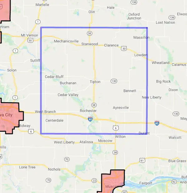
There are no geographical USDA loan restrictions in this county. 100% of Cedar County is eligible for rural development USDA home loans.
The United States Department of Agriculture has rated the natural amenities of this region. On a scale of one to seven, Cedar county is rated a 2. The average temperature during the month of June is 73.9℉ and the average temperature in January is 20.4℉. The typical humidity of this area is approximately 60% and the area covered by water is 0.42%. The overall influence score for Cedar is 6.
The map below displays geographic boundaries of Cedar, Iowa with a blue border. There are no significant USDA regional restrictions in this county. For higher resolution imagery click the map to zoom in or search for specific postal (zip) codes, city names or even counties. You can also search for specific addresses using the power search feature here.
Select from the above list of cities in Cedar County. Cities most likely to have USDA loan eligible properties are highlighted in the drop down list. Alternatively, use the search form to find your favorite counties, cities and zip codes in Iowa.

Cedar County is located in the northeastern corner of the state of Iowa. According to the 2019 U.S. Census Bureau estimates, Cedar County has a total population of 18,832 people. Of that population, 94% are White, 2% are Hispanic or Latino, 1% are Asian, and 1% are two or more races. The median household income is $53,619 and the median age is 44 years old.
The county is made up of mostly rural communities and agricultural land. The largest city in Cedar County is Tipton, with a population of 2,199 as of 2019. Other cities in the county include Clarence, Durant, Stanwood, and Wilton. The county has a total area of 577 square miles, with an average elevation of 825 feet above sea level.
The climate in Cedar County is humid continental with cold winters and hot summers. The average temperature ranges from -4 degrees F in January to 81 degrees F in July.
Cedar County offers its residents a variety of recreational activities including hunting, fishing, camping, hiking, and canoeing on the Cedar River. Cedar County also offers numerous parks and trails for outdoor recreation.
Cedar, Iowa

Loan officers and realtors can answer your questions about USDA home loan programs.
For direct assistance with Iowa USDA program details you can also contact:
Iowa Contact InformationFeatured Property from USDA Loan Eligible Regions of Iowa
State Office
210 Walnut Street, Room 873
Des Moines, Iowa 50309
ph: 515-284-4663
fax: 855-251-2243

