Loading Data
USDA Eligibility Boundaries for Louisa, Iowa 

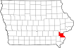
There are no geographical USDA loan restrictions in this county. 100% of Louisa County is eligible for rural development USDA home loans.
The United States Department of Agriculture has rated the natural amenities of this region. On a scale of one to seven, Louisa county is rated a 3. The average temperature during the month of June is 74.5℉ and the average temperature in January is 22.2℉. The typical humidity of this area is approximately 60% and the area covered by water is 3.77%. The overall influence score for Louisa is 6.
The map below displays geographic boundaries of Louisa, Iowa with a blue border. There are no significant USDA regional restrictions in this county. For higher resolution imagery click the map to zoom in or search for specific postal (zip) codes, city names or even counties. You can also search for specific addresses using the power search feature here.
Select from the above list of cities in Louisa County. Cities most likely to have USDA loan eligible properties are highlighted in the drop down list. Alternatively, use the search form to find your favorite counties, cities and zip codes in Iowa.

Louisa County is located in southeastern Iowa, near the Mississippi River. The population of Louisa County is estimated to be around 11,000 people. The county's population is mostly rural, with a few small towns scattered throughout.
The median household income in Louisa County is around $50,000, and the median age is 44. The racial makeup of the county is 95.9% White, 1.2% African American, 0.4% Native American, 0.6% Asian, and 1.1% from other races.
The majority of residents in Louisa County live in single-family homes, and the area is home to many farms and agricultural businesses. The county also has several small businesses, including manufacturing, retail stores, and service providers.
Overall, Louisa County offers a peaceful and rural lifestyle with access to all the amenities of larger cities nearby.
Louisa, Iowa

Loan officers and realtors can answer your questions about USDA home loan programs.
For direct assistance with Iowa USDA program details you can also contact:
Iowa Contact InformationFeatured Property from USDA Loan Eligible Regions of Iowa
State Office
210 Walnut Street, Room 873
Des Moines, Iowa 50309
ph: 515-284-4663
fax: 855-251-2243