Loading Data
USDA Geographic Eligibility Statistics for Kansas Postal Zip Code 67578

1.7% of Kansas is ineligible for rural development USDA home loans.
Postal code 67578 is used by homes and businesses in and around Stafford, Kansas, and covers 581.3 square kilometers. There are no significant geographical USDA loan restrictions within this area.
USDAProperties.com can help you determine precisely what properties are inside USDA loan eligibility boundaries.
Contact realtors  familiar with this area. For high resolution boundaries click the map icon to zoom in on postal (zip) code 67578

Or use the search form to find your favorite counties, cities and zip codes in Kansas.
Interested in some fun facts and history about Stafford, KS?
Read on!
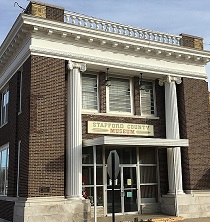
The village of Stafford, Kansas is part of Stafford County, located in the central part of the state. It has a population of approximately 1,000 residents and covers an area of 1.17 square miles. The village was founded in the 1870s as a farming community and has since grown to include a diverse range of industries, including oil and gas production, agriculture, and small businesses. The village has a historic downtown area with a number of shops and restaurants, as well as several community parks and recreational facilities. Notable landmarks in and around Stafford include the Stafford County Courthouse, Wilmore State Lake, and the Kansas Wetlands Education Center.
State Office - TopekaFeatured Property from USDA Loan Eligible Regions of Kansas
1303 SW First American Place, Suite 100
Topeka, KS 66604
(785) 271-2700
Hays Office
(785) 628-3081
Iola Office
(620) 365-2901
Newton Office
(316) 283-0370