Interested in fun facts and the history of Shelburne Falls, MA?
Then read on!
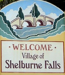
Shelburne Falls is a charming village located in the western part of Massachusetts, in the foothills of the Berkshire Mountains. It is primarily divided into two parts by the Deerfield River: the Shelburne side of the river, which is part of Shelburne town, and the Buckland side of the river, which is part of Buckland town. Shelburne Falls has a population of approximately 1,700 residents.
The village is known for its picturesque scenery, including the historic Bridge of Flowers, which is a former trolley bridge that has been transformed into a garden, and the glacial potholes, which are naturally occurring cylindrical holes that have been formed in the rocky riverbed.
Shelburne Falls also has a vibrant arts community, with several galleries, studios, and artisan shops located in the village center. The village hosts various events throughout the year, such as the Moonlight Magic holiday celebration, the Syrup Festival in March, and the annual Bridge of Flowers Road Race.
Overall, Shelburne Falls is a lovely destination for visitors who enjoy natural beauty, artistic expression, and small-town charm.