Interested in fun facts and the history of Sterling, MA?
Then read on!
Here are some facts about Sterling, Massachusetts:
- Sterling is a town located in Worcester County, Massachusetts, United States.
- The town covers an area of approximately 31 square miles, and has a population of around 8,000 people.
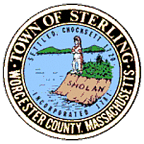
- Sterling was first settled in 1720 and was officially incorporated in 1781.
- The town was originally part of the nearby town of Lancaster, but it became its own town due to disagreements over church locations and taxation.
- The town is known for its historic buildings, including the Sterling Meetinghouse, which was built in 1839 and is one of the town's most recognizable landmarks.
- Sterling is home to numerous parks and outdoor recreational areas, including Mount Wachusett, Wachusett Reservoir, and Sterling Town Forest.
- Mount Wachusett, which is part of the Wachusett Mountain State Reservation, offers hiking, skiing, and other outdoor activities.
- The town's economy is largely based on agriculture and small businesses, with many residents working in nearby cities like Worcester or Boston.
- Sterling is also home to several schools, including the Houghton Elementary School, Chocksett Middle School, and Wachusett Regional High School.