Loading Data
USDA Geographic Eligibility Statistics for Massachusetts Postal Zip Code 01351

23.9% of Massachusetts is ineligible for rural development USDA home loans.
Postal code 01351 is used by homes and businesses in and around Montague, Massachusetts, and covers 55.3 square kilometers. There are no significant geographical USDA loan restrictions within this area.
USDAProperties.com can help you determine precisely what properties are inside USDA loan eligibility boundaries.
Contact realtors  familiar with this area. For high resolution boundaries click the map icon to zoom in on postal (zip) code 01351

Or use the search form to find your favorite counties, cities and zip codes in Massachusetts.
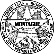
Interested in some fun facts and history about Montague, MA?
Read on!
Here are some facts about Montague, Massachusetts:
- Montague is located in the northwest part of Franklin County, Massachusetts
- The town has a population of around 8,000 people
- The village of Turners Falls, which is located in Montague, is home to the Brockway Ferry, a cable ferry that crosses the Connecticut River
- Montague is often referred to as the "Gem of the Valley" due to its picturesque landscapes and charming, small-town vibe
- The town is home to several notable landmarks, including the French King Bridge, which spans the Connecticut River, and the Montague Bookmill, a popular used bookstore housed in a former mill.
The Massachusetts State Office, located in Amherst, MA, administers activity in Massachusetts, Connecticut, and Rhode Island. Massachusetts area offices are located in Hadley, Holden and West Wareham. All offices are open to the public Monday through Friday from 8:00 a.m. until 4:30 p.m.Featured Property from USDA Loan Eligible Regions of Massachusetts