Loading Data
USDA Eligibility Boundaries for Catron, New Mexico 

There are no geographical USDA loan restrictions in this county. 100% of Catron County is eligible for rural development USDA home loans.
The United States Department of Agriculture has rated the natural amenities of this region. On a scale of one to seven, Catron county is rated a 6. The average temperature during the month of June is 67.5℉ and the average temperature in January is 30.7℉. The typical humidity of this area is approximately 36% and the area covered by water is 0.02%. The overall influence score for Catron is 9.
The map below displays geographic boundaries of Catron, New Mexico with a blue border. There are no significant USDA regional restrictions in this county. For higher resolution imagery click the map to zoom in or search for specific postal (zip) codes, city names or even counties. You can also search for specific addresses using the power search feature here.
Select from the above list of cities in Catron County. Cities most likely to have USDA loan eligible properties are highlighted in the drop down list. Alternatively, use the search form to find your favorite counties, cities and zip codes in New Mexico.

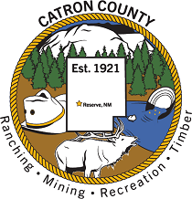
Catron County is located in the southwestern corner of New Mexico, and is the largest county by area in the state. The population is approximately 3,700, and the county is home to several Native American tribes, including the Mescalero Apache, Navajo, and Jicarilla Apache.
The median household income for Catron County is $35,383, about half that of the state as a whole. Majority of the population lives in rural areas, with 27% living below the poverty line. Unemployment stands at 6%, slightly higher than both the state and national averages. About 28% of adults in Catron County have less than a high school degree.
Despite its remote location, Catron County has seen some economic growth due to the energy industry in recent years. Tourism also provides an economic boost to the area, as there are several state parks and forests in the county.
Catron, New Mexico

Loan officers and realtors can answer your questions about USDA home loan programs.
For direct assistance with New Mexico USDA program details you can also contact:
USDA Rural Development State OfficeFeatured Property from USDA Loan Eligible Regions of New Mexico
100 Sun Avenue NE, Suite 130
Albuquerque, NM 87109
Phone: 505-761-4950