Loading Data
Find USDA Eligible Properties in Pushmataha County

 browse list of realtors working in Pushmataha County
Pushmataha county has 1 usdaproperties.com realtor ready to help with your search!
| August 2024 Featured Agent | |
|---|---|
| Tawsha Davenport | from Keller Williams |
 Contact an Agent for Help
 Looking to buy in Pushmataha County, Oklahoma?
There are 25 USDA backed residential loans in Pushmataha county with an average loan balance of $75,810. Over 92% of the loans helped first time home buyers. Borrowers were an average age of 42 years old. The typical appraised home value was around $76,920. On average the rural home size purchased with this loan was approximately 1,532 SqFt. Pushmataha county applies the standard USDA income limits to determine loan eligibility. For a household of upto 4 people the income limit is $90,300. For a household of between 5 and 8 people the income limit is increased to $119,200.
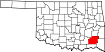
The size of Pushmataha County is roughly 3,684 square kilometers. There are no geographical USDA loan restrictions in this county. The influence score for Pushmataha County is 8. Look below for the interactive county level map illustration below for more details.
Select from the list of cities below or use the search feature to find active property listings in a city where you would like to live.
Start your search for USDA loan eligible properties in the cities of Pushmataha County, OK 
* cities most likely to have USDA loan eligible properties for sale.
Adel • *Albion • *Antlers • Belzoni • Big Rocks • Burwell • *Clayton • Cloudy • Corinne • Dela • Divide • Ethel • Eubanks • Fewell • Finley • Greenwood • Jumbo • Kellond • Kiamichi • Kosoma • Miller • Moyers • Nashoba • Nolia • North Sobol • Oleta • *Rattan • Sardis • Snow • Sobol • Stanley • *Tuskahoma • Wadena
A USDA loan is a mortgage option available to eligible homebuyers that is sponsored by the United States Department of Agriculture to promote homeownership in rural communities. USDA Loans, sometimes called "RD Loans," offer 100% financing options on eligible rural properties. USDAProperties can help you find USDA properties in Pushmataha County.
View the detailed USDA boundaries and read about general conditions of
Pushmataha County, Oklahoma
 .
.Pushmataha County, located in southeastern Oklahoma, covers approximately 1,423 square miles and was created in 1907 when Oklahoma became a state. It was named in honor of the Choctaw Nation Chief Pushmataha, who served as a military leader, and US-ally during the War of 1812.
The area was originally inhabited by various Native American tribes, such as the Caddo and Osage, until the Choctaw tribe was forcibly relocated to the region as part of the Indian Removal Act in the 1830s. This relocation, known as the Trail of Tears, brought the Choctaw tribe from their ancestral lands in Mississippi and surrounding states to the new Indian Territory in present-day Oklahoma.
During the Civil War, the Choctaw Nation largely supported the Confederacy, but the county saw little direct conflict during the war. After the war, the Dawes Act of 1887 led to the allotment of individual plots of land to tribal members, breaking up tribal governments and communal lands.
Pushmataha County's economy has historically been driven by agriculture, timber, and coal mining. The region experienced growth after the arrival of the railroad in the early 20th century, which connected it to the broader economic scope of the United States.
A fun fact about Pushmataha County is that it is home to the "Antlers Deer Capital of the World." Antlers, a city in the county, earned this nickname due to the area's high population of white-tailed deer and is a popular location for deer hunting enthusiasts.
Featured Cities of Oklahoma