Loading Data
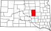
USDA Eligibility Boundaries for Hand, South Dakota 

There are no geographical USDA loan restrictions in this county. 100% of Hand County is eligible for rural development USDA home loans.
The United States Department of Agriculture has rated the natural amenities of this region. On a scale of one to seven, Hand county is rated a 2. The average temperature during the month of June is 74.0℉ and the average temperature in January is 15.0℉. The typical humidity of this area is approximately 49% and the area covered by water is 0.25%. The overall influence score for Hand is 9.
The map below displays geographic boundaries of Hand, South Dakota with a blue border. There are no significant USDA regional restrictions in this county. For higher resolution imagery click the map to zoom in or search for specific postal (zip) codes, city names or even counties. You can also search for specific addresses using the power search feature here.
Select from the above list of cities in Hand County. Cities most likely to have USDA loan eligible properties are highlighted in the drop down list. Alternatively, use the search form to find your favorite counties, cities and zip codes in South Dakota.

Hand County is located in the northeastern corner of South Dakota, and is home to approximately 3,400 people. The county has a rural population with a median household income of $45,898. The population is almost entirely white, with only 0.4% being Hispanic or Latino.
The living conditions in Hand County are generally good, with a comfortable climate and plenty of open space for outdoor recreation. The area has a low cost of living and housing is relatively affordable.
The quality of life in Hand County is generally positive. Residents enjoy access to high-quality public schools, ample recreational opportunities, and a strong sense of community. The area has a low crime rate, making it a safe place to live and raise a family.
Hand, South Dakota

Loan officers and realtors can answer your questions about USDA home loan programs.
For direct assistance with South Dakota USDA program details you can also contact:
USDA Rural Development State OfficeFeatured Property from USDA Loan Eligible Regions of South Dakota
200 4th Street SW, Federal Building, Rm. 210
Huron, SD 57350
Phone: (605) 352-1100
Facsimile: (855) 262-1940