Loading Data
Find USDA Eligible Properties in Mineral County
 browse list of realtors working in Mineral County
Mineral county has 1 usdaproperties.com realtor ready to help with your search!
| April Featured Agent | |
|---|---|
| Theresa Lunn | from United Country-Western Montana Group, LLC |
Looking to buy in Mineral County, Montana?
There are 39 USDA backed residential loans in Mineral county with an average loan balance of $112,456. Over 84% of the loans helped first time home buyers. Borrowers were an average age of 43 years old. The typical appraised home value was around $116,155. On average the rural home size purchased with this loan was approximately 1,161 SqFt. Mineral county applies the standard USDA income limits to determine loan eligibility. For a household of upto 4 people the income limit is $90,300. For a household of between 5 and 8 people the income limit is increased to $119,200.
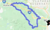
The size of Mineral County is roughly 3,166 square kilometers. There are no geographical USDA loan restrictions in this county. The influence score for Mineral County is 9. Look below for the interactive county level map illustration below for more details.
Select from the list of cities below or use the search feature to find active property listings in a city where you would like to live.
Start your search for USDA loan eligible properties in the cities of Mineral County, MT ![]()
* cities most likely to have USDA loan eligible properties for sale.
*Alberton • Borax • Bryson • Cabin City • Cyr • *De Borgia • Drexel • East Portal • Foraker • Haugan • Henderson • Keystone • Lozeau • Quartz • *Riverbend • *Saint Regis • Saltese • Sohon • Spring Gulch • *Superior • Taft • Tarkio • Toole • Westfall
A USDA loan is a mortgage option available to eligible homebuyers that is sponsored by the United States Department of Agriculture to promote homeownership in rural communities. USDA Loans, sometimes called "RD Loans," offer 100% financing options on eligible rural properties. USDAProperties can help you find USDA properties in Mineral County.
View the detailed USDA boundaries and read about general conditions of
Mineral County, Montana
 .
.Mineral County is situated in the northwestern region of the great state of Montana. Established on August 7, 1914, it was carved out of Missoula County and named Mineral County due to the huge reserves of minerals found in the area. This region spans across 1,223 square miles, of which about 14 square miles is water, including the scenic Clark Fork River, which runs through the county.
The first inhabitants of the area were the Salish and Pend d'Oreille peoples, who eventually merged with the Kootenai tribe. European-American settlers arrived in the mid-19th century and started working in mining, timber, and agriculture, laying the foundation for the county's economy.
The St. Paul Pass Tunnel, also known as the Taft Tunnel, is an interesting feature in the county. Completed in 1908, it is a 1.7-mile-long tunnel that travels beneath the Bitterroot Mountains, connecting Montana to Idaho. The tunnel played a significant role in railroad transportation, enabling easy travel through the foggy and mountainous landscape.
A fun fact about Mineral County is that it is home to the breathtaking Lolo National Forest, which covers over 2 million acres. The forest is popular for its diverse plant and animal life, outdoor recreational activities, and stunning landscapes, attracting nature enthusiasts year-round.
Featured Cities of Montana


